


RETURN TO MAIN NORTHERN BELTLINE PAGE
Maps
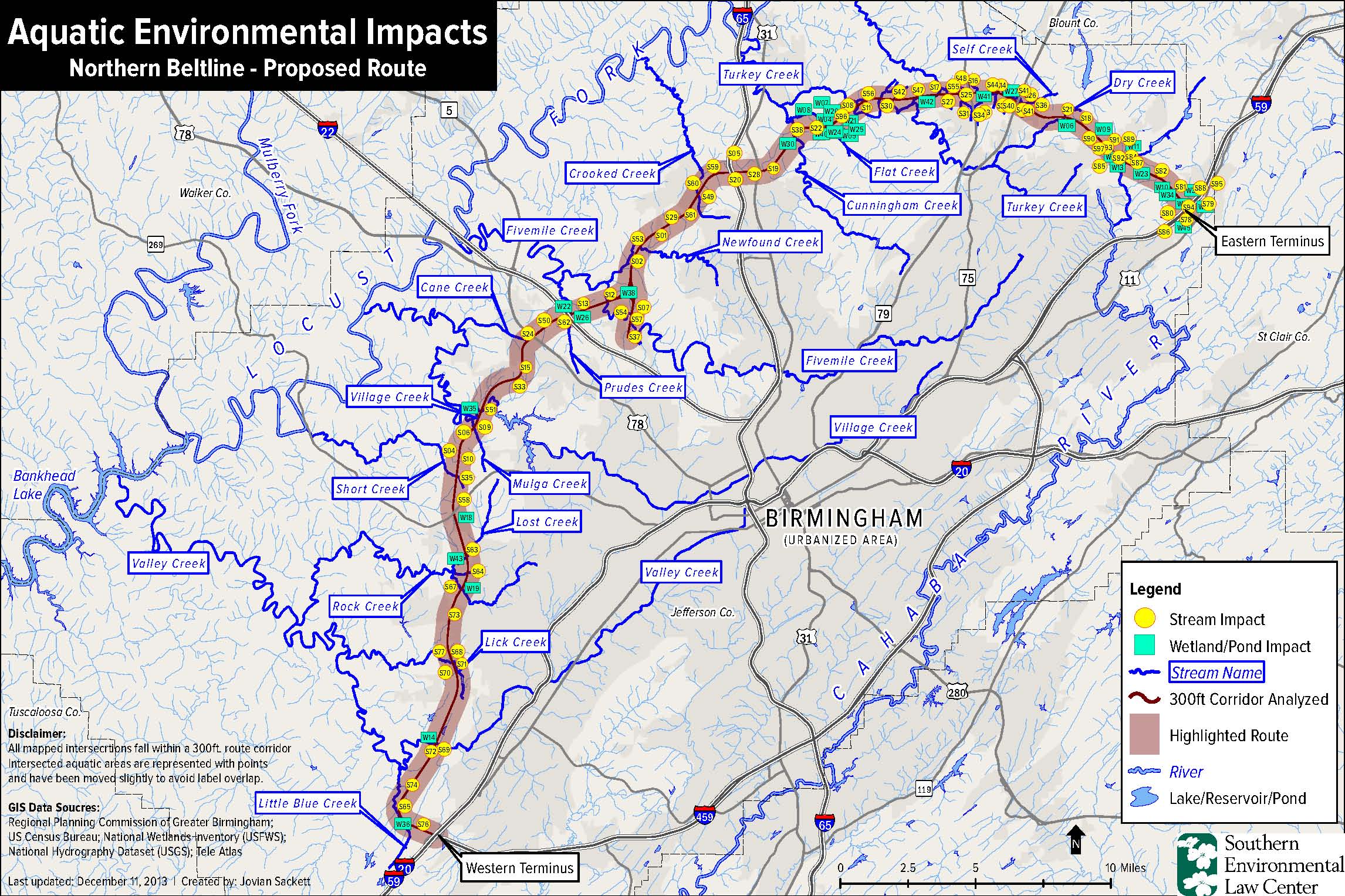
The highway will cross and permanently alter Black Warrior and Cahaba river tributaries in 90 places (including impacts to two major sources of drinking water). It will destroy 35 wetlands and 3,078 football fields’ worth of forest.Click for a larger version: http://www.blackwarriorriver.org/images/NB.Aquatic-Impacts.MAP_12.11.13.jpg
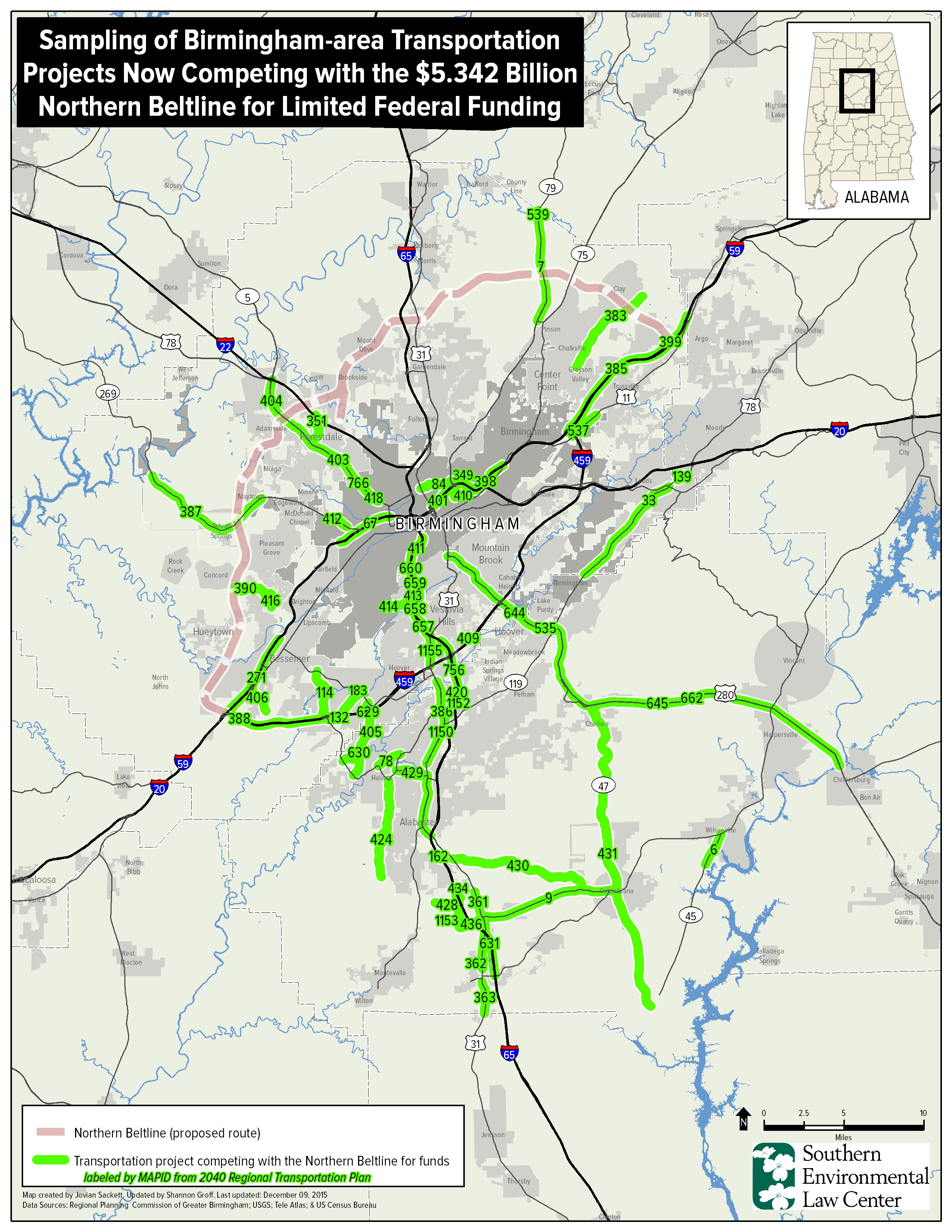
Birmingham Area Transportation Projects Competing with Beltline for Funds.Click for a larger version: http://blackwarriorriver.org/wp-content/uploads/2015/12/MAP_NorthernBeltline_CompetingFunds_5.342billion_2040_portrait_updated1292015.jpg
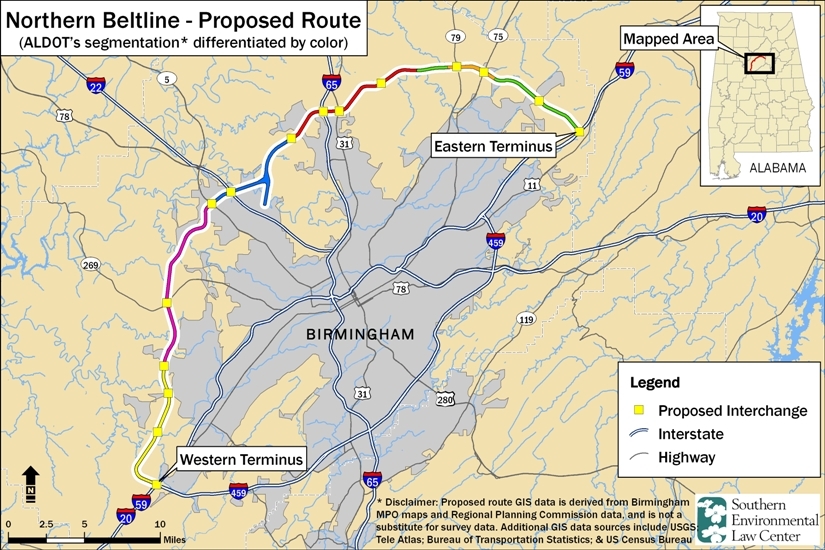
Proposed Northern Beltline Route in Jefferson County, AL (SELC – 4/12/11) Click for a larger version: http://www.blackwarriorriver.org/pdf/2011-04-12%20NB%20route.pdf

Existing Jefferson County Sewer Infrastructure Juxtaposed with Northern Beltline (4/17/12) Click for a larger version: http://www.blackwarriorriver.org/images/northern_beltline_bham_sewers.SELC_4.17.12.jpg
Large Landowners Along the Beltline (Birmingham News – 12/13/09)
http://media.al.com/bn/other/1213BELTPROP.pdf
Projected Jefferson County Population Growth (Birmingham News – 12/13/09)
http://media.al.com/bn/other/1213BELTPOPU.pdf
RETURN TO MAIN NORTHERN BELTLINE PAGE